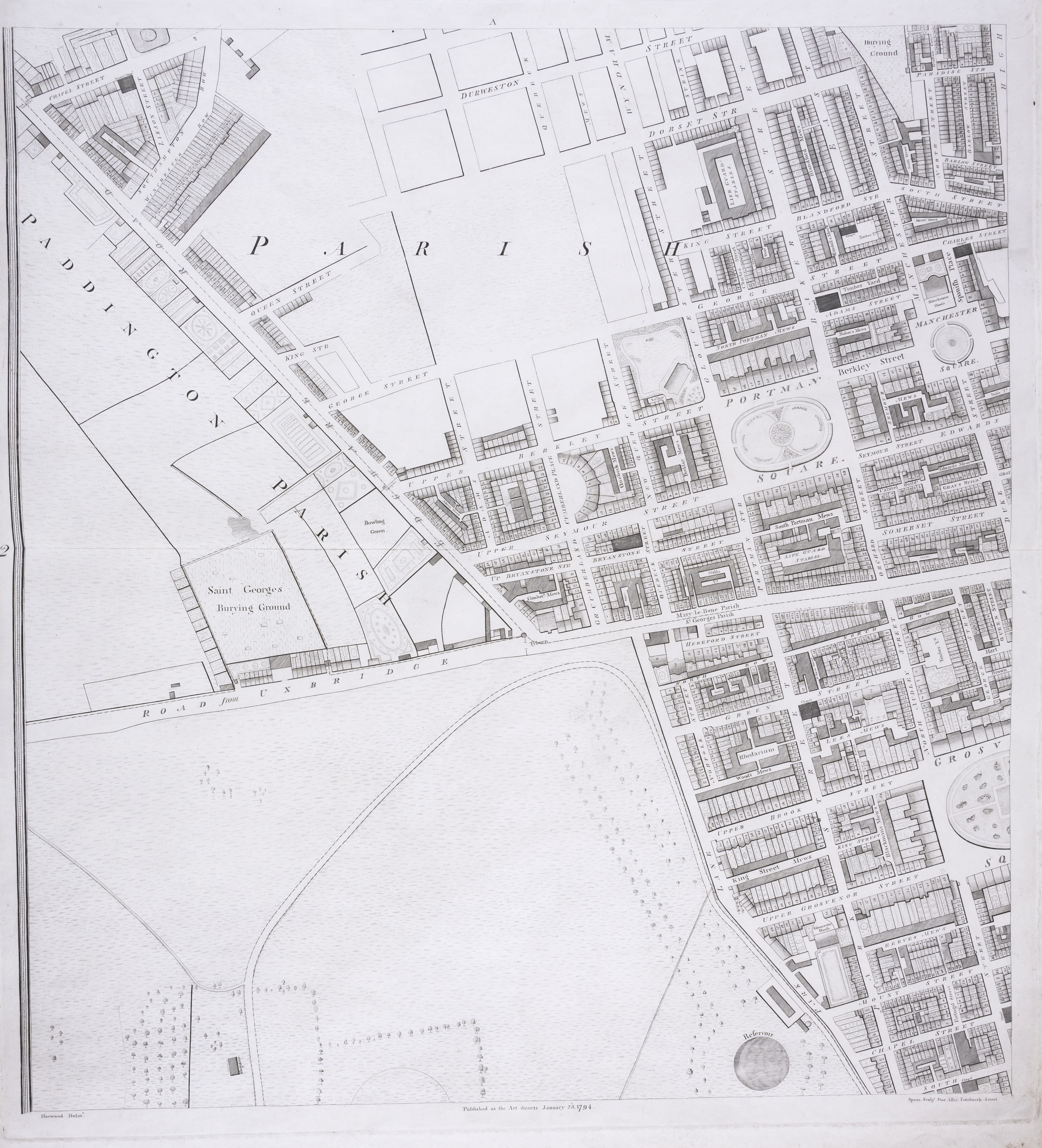
London.- Horwood (Richard) Plan of the Cities of London and Westminster the Borough of Southwark ...
London.- Horwood (Richard) Plan of the Cities of London and Westminster the Borough of Southwark and Parts adjoining Shewing every House , large bound wall map of London, composite collection from the first and second editions, 23 sheets only (of 32, lacking sheets A4, B2-B3, C2, D2, E3-E4, F3-F4, G3-G4, H3-H4), presented on a scale of twenty-five inches to the mile, extending from Angel to Limehouse, and Kennington to Brompton, engravings on various cream wove papers, some with watermarks 'Horwood's Map of London', each individual sheets approx. 560 x 650 mm (22 x 25 1/2 in), or smaller with some sheets trimmed, some on stubs, some loose, scattered surface dirt, occasional nicks to extremities, later half calf, covers detached, lacking spine, manuscript inscription to upper cover, very worn, elephant folio, [cf. Howgego 200], [c.1792-1807] *** The largest map printed in Georgian Britain, and a defining study of London at the end of the eighteenth century. Horwood's plan was the first map of London to attempt to show every individual property, and took over 7 years to complete following numerous logistical and financial obstacles.
- The cost is converted to USD at the rate of 1 GBP = 1.271325 USD on 2024-01-25.
-
Sign in to view
Lot number
-
Sign in to view
Estimate
-
2024-01-25
Sale date
-
Sign in to view
Realised price
-
Sign in to view
Opening price
-
Sign in to view
House name
-
Sign in to view
Auction sale name
-
Sign in to view
Country
-
Categories
Sign in to view -
Tags
Sign in to view